You want the freedom to swim off your own dock, launch the boat with ease, and enjoy quiet mornings on Lake Pend Oreille. But listing language like deeded waterfront, OHWM, and assigned moorage can be confusing. If you get the terms wrong, you risk surprises later. In this guide, you’ll learn plain-English definitions, how the terms affect everyday use and value, and the exact checks to make before you tour or write an offer in Sandpoint. Let’s dive in.
What “deeded waterfront” really means
Deeded waterfront usually means your property line runs to the water’s edge, often to a boundary like the ordinary high-water mark. That implies you have exclusive access to the shoreline included within your deed.
Here’s the nuance. Even deeded shoreline can be subject to state public-trust rights, recorded easements, or rules that limit structures and uses. A listing that says deeded does not guarantee unrestricted dock rights. You should confirm the deed and consult local permitting authorities before you assume anything about moorage.
Littoral and riparian rights explained
Littoral rights typically apply to lakes and oceans. They relate to access and reasonable use of the water for owners whose land borders the lake.
Riparian rights typically apply to rivers and streams. Rules are different because the water flows. In some places, who owns to the midline of the stream and how you can use the water depend on state law.
For Lake Pend Oreille, you will see littoral used more often. Exact rights and limits depend on Idaho law and whether a waterbody is navigable. When in doubt, verify with the appropriate state agencies.
Lakefront vs. riverfront in Sandpoint
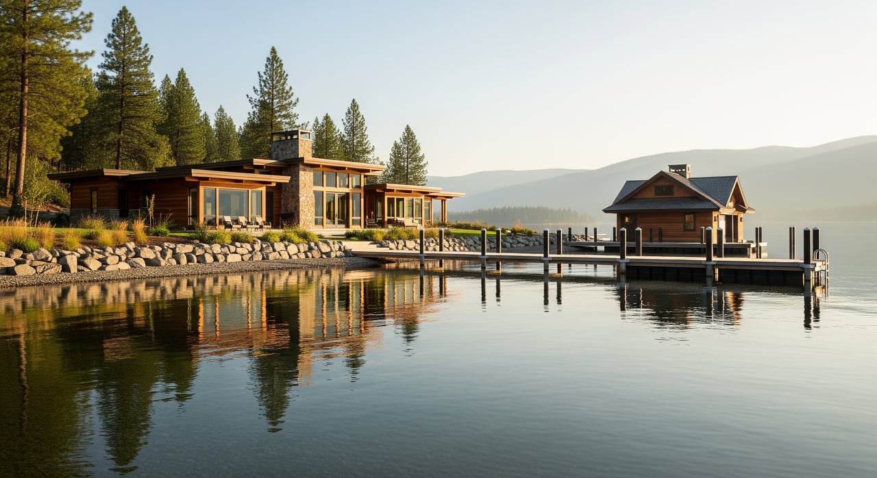
Lakefront lots border Lake Pend Oreille. You can expect broader frontage, open water for boating, and potential for docks or buoys if permitted.
Riverfront lots border a river or creek. You may see narrower frontage, current, different erosion dynamics, and more constraints on docks. Some buyers prefer riverfront for fishing or canoeing, while others prefer lakefront for boating.
Community and shared access terms
Community waterfront or association access means owners use shared access managed by an HOA or an easement. Benefits can include docks, beaches, or a boat launch. The rights and rules live in recorded documents like CCRs or easements.
Shared frontage or common shoreline means several lots share one physical stretch of shoreline or an undivided interest in it. You may have rights, but not exclusive possession of a particular segment unless agreements or surveys say otherwise. Expect rules for moorage placement and shared maintenance.
Easements and how they work
Access easements allow one party to cross another’s property to reach the water. Appurtenant easements run with the land and will show up in title. Prescriptive rights can arise from long-term use in some situations, but you should never assume casual use creates legal rights. Always check recorded documents.
Undeveloped vs. improved shoreline
Undeveloped shoreline features natural banks with more vegetation and potential erosion limits. There may be fewer moorage improvements.
Improved shoreline includes docks, bulkheads, seawalls, or stairs. These improvements often require permits and approvals from local, state, or federal agencies. If a seller added improvements without proper permits, they may not transfer cleanly and could even need removal.
Deeded dock vs. assigned moorage
A deeded dock is referenced in the deed or plat as belonging to the parcel. That is stronger than a club or HOA assignment.
Assigned moorage is an HOA or marina assignment rather than title-based ownership. It can change under HOA rules or availability. Confirm how moorage is granted, if it can be transferred, and what rules apply.
High-water line and boundaries
The ordinary high-water mark (OHWM) is a technical boundary that often separates private ownership from state-owned bedlands. The visual shoreline is not always the legal boundary. A survey and agency standards determine how the OHWM is measured. You should not assume your lawn edge equals your lot line.
Who controls what in Sandpoint
Ownership and state trust interests can overlap. Many states hold the beds of navigable waters in trust for the public, and private ownership often ends at a mark such as the OHWM. That means listings that say deeded waterfront can still be subject to public-trust rights.
Rules and permits may involve several entities. In Bonner County and around Lake Pend Oreille, the agencies that commonly matter include Bonner County Planning and Zoning, the Idaho Department of Water Resources, the Idaho Department of Lands, the U.S. Army Corps of Engineers, and the Idaho Department of Fish and Game. FEMA floodplain maps and local marina or lake groups often also play a role in practical use.
Docks, seawalls, and shoreline stabilization
Many shoreline structures require permits. In some situations you need approvals from county, state, and federal agencies. Work that affects navigable waters or wetlands often triggers federal review. Unpermitted work can result in denial or removal.
Shoreline modifications can come with seasonal work windows, environmental review, and mitigation. Always ask for copies of permits and compliance records before you rely on existing structures.
Water levels on Lake Pend Oreille
Lake Pend Oreille’s water level is influenced by operations at Albeni Falls Dam, which is run by the U.S. Army Corps of Engineers. Seasonal fluctuations can affect when docks are usable and what depth you will have under your boat at different times of year. If year-round moorage matters to you, ask for historical patterns and practical local guidance.
Everyday use and privacy impacts
Private, deeded frontage offers the most direct shore access for swimming and day-to-day convenience. It also tends to feel more private, though vegetation and topography do a lot to shape actual privacy.
Community and shared access are great if you prefer low maintenance, but expect more people nearby at peak times. Parking, launch capacity, and guest policies are set by the HOA or easement language.
Moorage potential and boats
Your ability to keep a boat at the property depends on depth, permits, and rules. Key checks include:
- Depth at the shoreline and offshore. Confirm draft requirements for your vessel.
- Whether a dock or buoy is permitted and transferable.
- HOA rules, no-wake zones, and navigation channels that may limit moorage.
- Underwater hazards that affect placement.
If there is no dock, ask for bathymetric information or measured depth where you plan to moor.
Value and cost implications
In general, private deeded lakefront with a permitted dock and favorable topography commands the highest premium. Community access lots sell for less than private waterfront but often more than inland property, depending on the quality of access and amenities.
Riverfront value varies with frontage size, flood or erosion risk, navigability, and view. Negative value factors include lack of legal moorage, unresolved easements or disputes, shoreline stability problems, significant setbacks, and frequent water-level fluctuation. Ongoing expenses can include flood insurance, HOA assessments for docks or shoreline maintenance, and potential increases in property taxes for permitted improvements.
Due diligence checklist for buyers
Request or verify these items before you tour or write an offer:
- Recorded deed and any easements or restrictions. Look for exact shoreline rights.
- Current title report with exceptions and encumbrances.
- Recent ALTA or land survey showing lot lines, measured frontage, and the OHWM relationship.
- Recorded plat maps and CCRs if the property is in an HOA.
- All permits for docks, seawalls, and shoreline improvements, plus compliance records.
- HOA rules for moorage assignments, boat types, guest use, and assessments.
- Bathymetric charts or measured depth at the intended moorage location.
- Historical photos of the shoreline for accretion and erosion context.
- FEMA floodplain maps and any local flood studies.
Questions to ask the listing agent or seller:
- Does the deed grant exclusive shoreline access, and where does private ownership stop?
- Are there recorded easements across the property to the water?
- Is there an existing dock or slip, was it permitted, and can the permit transfer?
- Is the property subject to HOA or CCR rules that affect shoreline use or moorage?
- Is the shoreline shared or exclusive, and is there a written sharing agreement?
- Have there been disputes or notices from county or state agencies about the shoreline?
- How do seasonal water levels affect moorage and access throughout the year?
- Are there known erosion issues, bank instability, or septic setbacks near the shore?
Professionals and verifications to line up
- Title company or real estate attorney to review deed language and title exceptions.
- Licensed surveyor to confirm boundaries relative to the OHWM.
- Bonner County Planning and Zoning to verify setbacks and local permits.
- Idaho Department of Water Resources and Idaho Department of Lands for shoreline and submerged land guidance.
- U.S. Army Corps of Engineers for federal permit needs and lake operations questions.
- Local marina or harbor operators for practical moorage conditions and seasonal norms.
- Shoreline contractor or engineer to assess docks, stabilization, and erosion risk.
- Environmental consultant if wetlands or significant shoreline work are involved.
Sandpoint resource map for verification
When you need to confirm facts, start here:
- Bonner County Planning and Zoning and the Recorder’s Office for recorded plats, deeds, and permits.
- Bonner County GIS or the assessor’s parcel viewer to review parcel lines and possible easements.
- Idaho Department of Water Resources for water-rights and shoreline authorization questions.
- Idaho Department of Lands for navigability and submerged lands guidance.
- U.S. Army Corps of Engineers for federal permits and Albeni Falls Dam operations.
- FEMA Flood Map Service Center for base flood elevations and flood insurance guidance.
- Idaho Department of Fish and Game for marine rules and habitat advisories.
- Local groups such as Lake Pend Oreille associations and city marina offices for practical, on-the-water insights.
How to move forward with confidence
Clarity on terms turns a complex decision into a confident one. If you confirm deed language, boundary lines, permits, and seasonal water behavior before you fall in love with the view, you protect both your lifestyle and your investment. That is how you make Sandpoint waterfront ownership feel as good on day one as it does years later.
If you want a guided path through the due diligence, concierge tour planning, and negotiation, connect with the local team that does this every day. Reach out to Overland Reizen to align your wish list, verify the details, and secure the right North Idaho waterfront.
FAQs
What does “deeded waterfront” mean on Lake Pend Oreille?
- It usually means your deed includes the shoreline to a boundary like the ordinary high-water mark, but state public-trust rights and permits can still limit uses.
How are docks and buoys permitted in Sandpoint?
- Permits may involve Bonner County, Idaho agencies, and the U.S. Army Corps of Engineers, and you should verify that any existing structure is permitted and transferable.
What is the ordinary high-water mark (OHWM) in Idaho purchases?
- It is a technical boundary often used to separate private land from state-owned bedlands, and a survey plus agency standards determine where it lies.
How does community waterfront differ from private frontage?
- Community waterfront offers shared access under HOA rules or easements, while private frontage gives exclusive access but still may be subject to regulations.
How do seasonal water levels affect moorage on Lake Pend Oreille?
- Operations at Albeni Falls Dam influence lake levels, which can change dock usability and depth under your boat at different times of year.
What documents should I request before touring a waterfront home?
- Ask for the recorded deed and easements, title report, recent survey, permits for shoreline structures, CCRs, depth measurements, historic photos, and FEMA maps.